
MMSU, Geodatahost 1st RegionalGIS Roadshow
 MMSU successfully concluded the 1st Regional GIS Roadshow in partnership with Geodata Systems Technologies highlighting information on recent technological developments on GIS platform and providing an avenue where industry experts could present to current and potential GIS users the updates and insights on emerging trends in GIS.
Held at the Plaza del Norte Convention Center at Laoag City, IlocosNorteon the 13th and 14th of August 2013, the two-day event with the theme “GIS for Climate Change Adaptation” attracted almost one hundred participants in the region from the different government agencies and academic institutions in sharing information, experiences and learning. Activities during the conference included user presentations on conducted studies and some impact-based programs implemented focusing on disaster prevention and risk management using geographic information system (GIS), and discussions on several issues and concerns geared towards further development of the network.
The first day of the event featured technical sessions led by experts and specialists. Dr. Francisca N. Dayrit, Executive Vice-President of Geodata,stressed during the forum that disaster risk reduction and management can be a tool for climate change 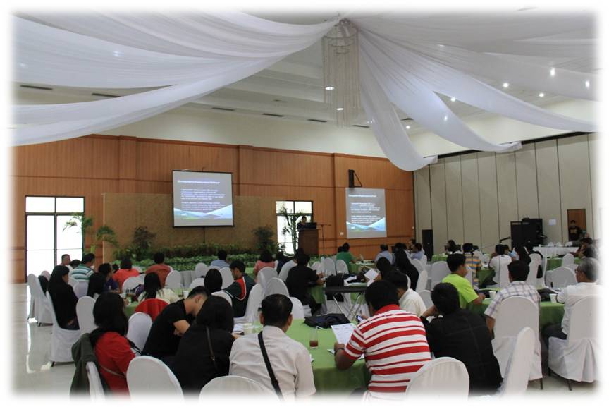 adaptation. Meanwhile, Dr. Nathaniel RAlibuyog, MMSU professor and GIS expert, featured his research entitled “Harnessing GIS and Remote Sensing Technology towards Improved Governance and Agricultural Productivity” and discussed the role of GIS and remote sensing in climate change adaptation. He stressed that with the help of GIS, more refined data can be gathered to make important decisions especially to the stakeholders and decision makers.
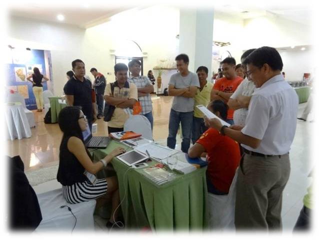
The afternoon session was, likewise, as informative and interesting. The plenary gave the delegates an opportunity to understand the amazing GIS capabilities;to recognize its accomplishments; observe demonstrations on the latest advances in the ArcGIS platform for climate change adaptation. In addition to the sessions, it also featured the “Meet the Experts” stalls which gave a unique opportunity to view the experts’ demonstration on how their equipment work, glimpse at theireducational research materials like catalogues and booklets on emerging trends and network with others involved in a geospatial world.
Delegates on the second day were encouraged to choose from 6 break-out sessions led by Geodata experts, offering them a comprehensive selection of topics that fit their interests like Disaster Risk Reduction Management using ArcGIS, ArcGIS for Local Government and Empowering Citizen Engagement with CloudGIS.
Through information sharing about GIS toolslearned from the experts, the delegates gained insight and showed intereston the techniques that utilize this technology for analysis and monitoring of climate change. Article and photos by Ma.Leoneza B. Rigonan
Recommended News
MMSU researcher wins national award using remote sensing technology
Dr. Nathaniel R. Alibuyog of MMSU racked up another honor to his growing list of awards. His research paper, together with Dr.Dionisio S. Bucao and Engr. Juanito M. Maloom Predicting rice yield from ....
GIS-RS Training: Addressing Climate Change, Enhancing Crop Productivity
Familiarization and utilization of Geographic Information System and Remote Sensing (GIS-RS) technology has played a significant role in research and development especially in agriculture. Geographic ....